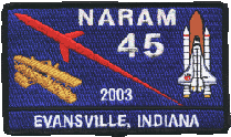
National Association of Rocketry Annual Meet
|
|
NARAM 45 National Association of Rocketry Annual Meet |
|
Directions to the Launch Site (N38.05984 W87.42601)
From the motels in Henderson, turn right (North) onto US Highway 41. Proceed approximately 5 miles to the I-164 interchange. Take the ramp for the Evansville bypass. Proceed approx 10 miles on I-164 to Exit 9. This is Morgan Ave/Indiana 62. Turn left (East) from the ramp onto Highway 62, passing the first crossroad and turning left (North) onto Stevenson Station Road. This is approximately a total of 2.3 miles. Proceed through the first intersection to Heim Road, a total of approximately 2 miles. Turn right onto Heim Road, go approximately 1 mile and turn left (North) onto Ashbury Cemetary Road. Go approximately 1.5 miles to the field entrance (on the left).
Traffic will be heavy Monday through Friday in the mornings in Henderson as traffic tends to become congested on the approach to the Ohio River Bridge so allow extra time to get onto I-164. After that, traffic flow will not be a problem.
Directions to Evansville
Follow directions to I-164. Take Exit 3. This is Green River Road. Go North on Green River for approximately 2.5 miles. This will take you to most of the restaurants and shopping areas on the East side of Evansville. Other restaurants and shopping areas are located on Lloyd Expressway. It can be accessed either from Green River Road (depending on road construction) or from Exit 7 on I-164.

 |
 |